KML support within the Telemetry Overlay software
(Basic support) Keyhole Markup Language is an XML notation for expressing geographic annotation and visualization within two-dimensional maps and Earth browsers. It was developed for use with Google Earth but is also compatible with programs like ArcGIS, Global Mapper, Blender, Merkaartor, Keyhole PRO... Data loggers like Ebike Analyzer, Foreflight and many more record to this format.
Custom KML shapes and layers are not supported for now. To display maps with custom layers see the information on custom MapBox styles.
Telemetry Overlay supports most video formats and dozens of embedded and external data formats.
Gauges can be customized to a great extent, but presets and defaults can make the user experience extremely easy.
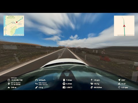
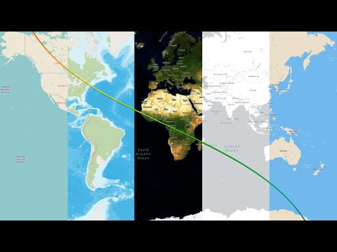
Map and satellite imagery is available for representing GPS data.
Export formats for both professional and social use are available.
Lots of documentation, tutorials and an active community help achieve great results.
Only a subset of KML formats is supported: Files with gx:Track elements containing coordinates and a "when" element, or Placemarks with Points and TimeStamps. To import other flavors of KML, try to convert them to one of the supported types of files (KML or other).
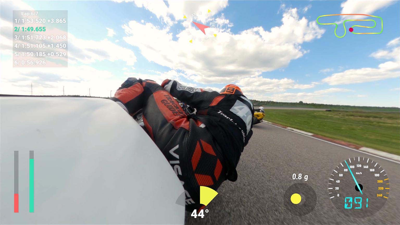
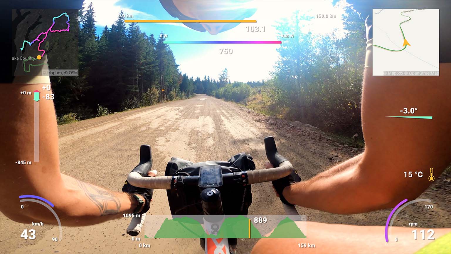
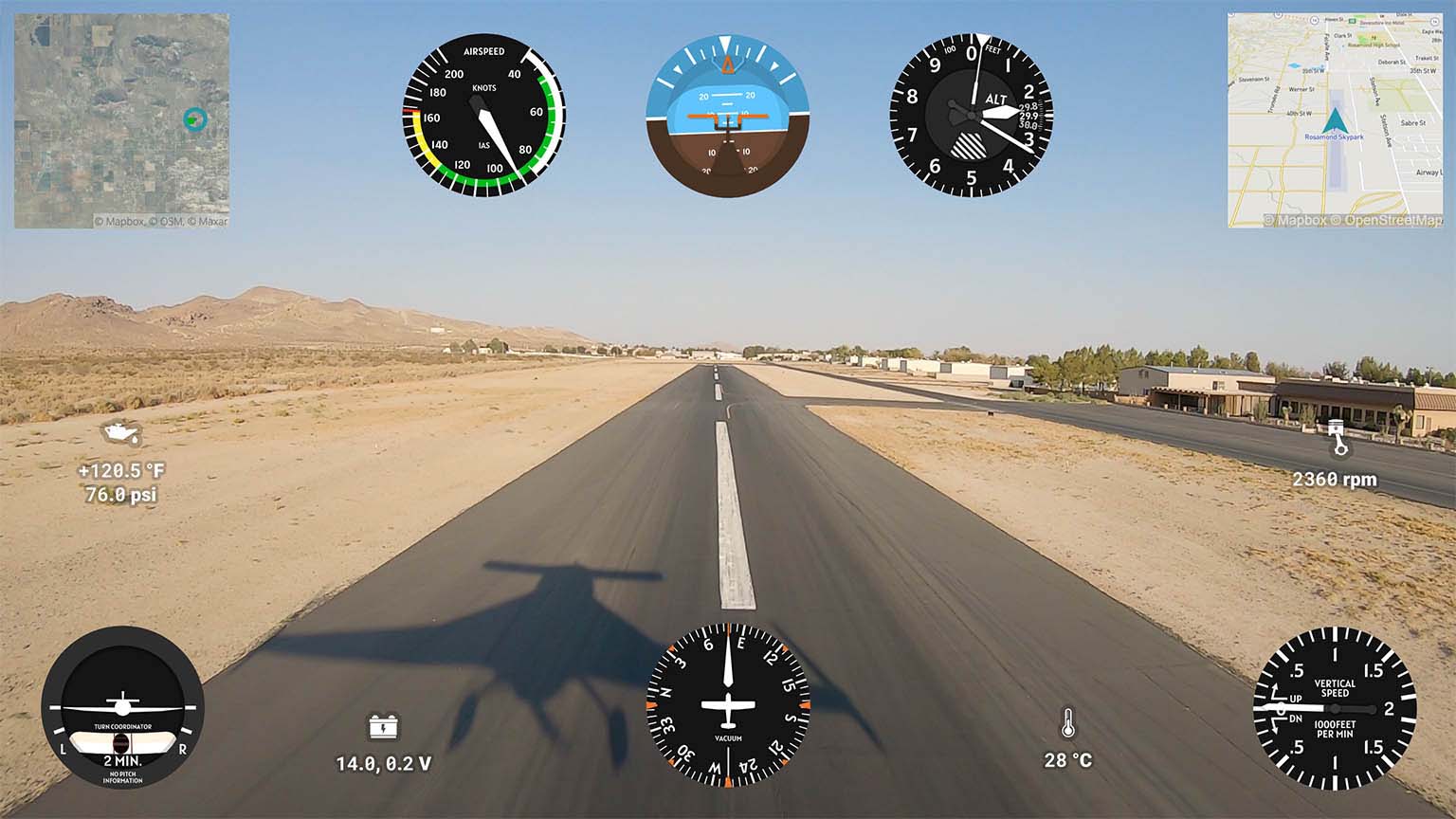
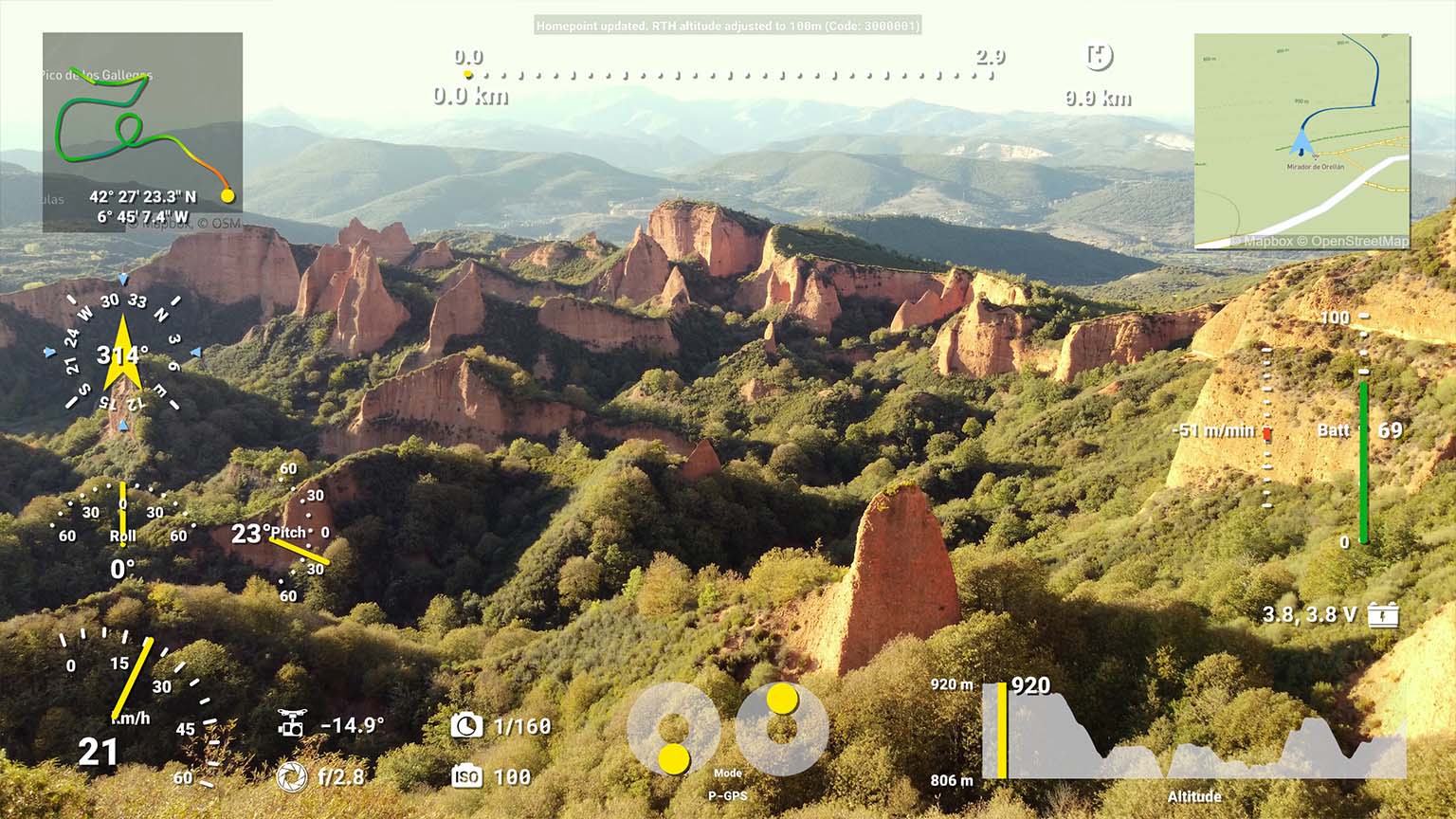
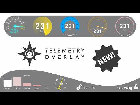
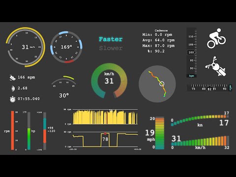
Supported gauges in Telemetry Overlay
Speedometer, GPS Path, Altitude, Distance, Slope, Dynamic Map, Bearing, Acceleration (GPS), Time & Date, Lap Timer, Pace, Vertical Speed, Elevation Gain, Coordinates, Altitude vs Distance, Orientation, Heading, Lean Angle, Lean Angle (2 wheel), Airspeed, Altimeter, Attitude Indicator, Heading Indicator, Turn Coordinator, Vertical Speed Indicator, Pitch Angle, Longitudinal Acceleration (GPS), Acceleration (speed-based), Lateral Acceleration (GPS), Zero to Speed, Distance Timer, GPS Path + Compass, Distance Home, Sector Times, Corner Speeds, Custom, Dynamic Text, Static Title, Static Image, Export GPX, Embed Timecode, Watermark and Additional streams.
Availability may vary between devices and recording conditions.
Have more questions? Check out the instructions manual, the tutorials, ask the community, experiment with the Trial version, or get in touch.
Telemetry Overlay
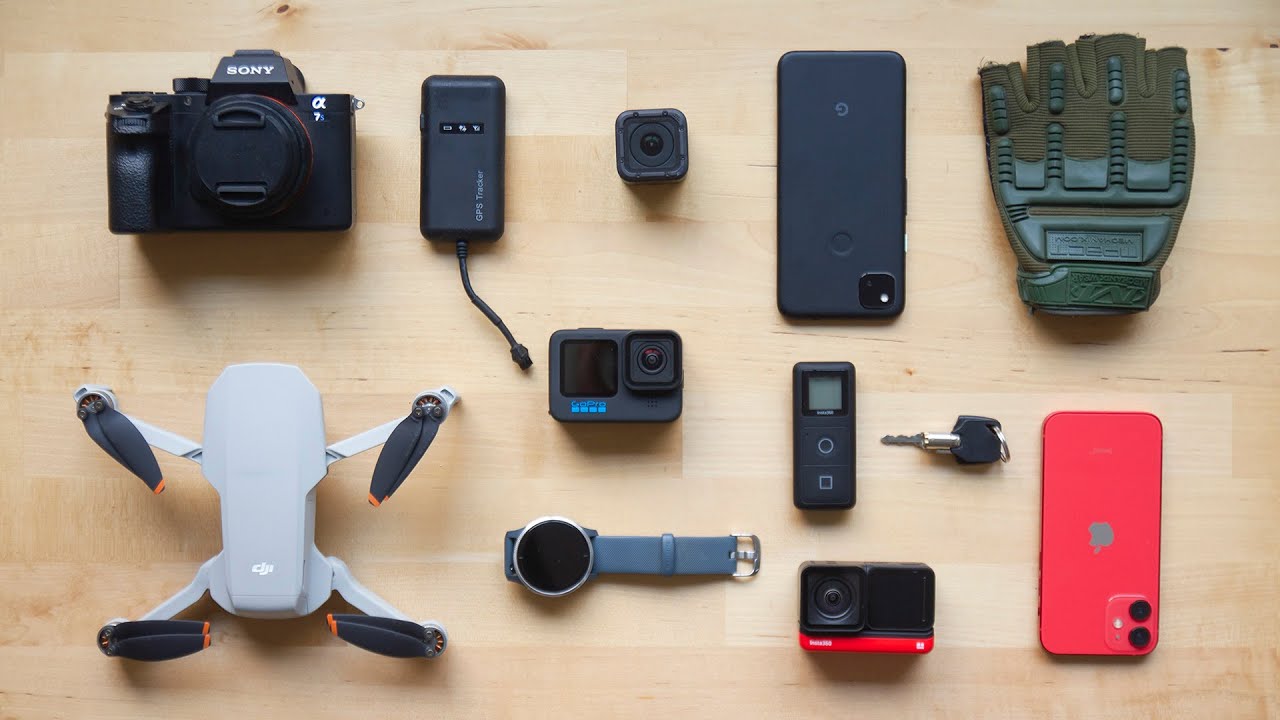
Finally! An easy all-in-one way to create a heads-up display for your action videos and drone footage. Compatible with multiple camera brands and data formats, including GoPro, DJI (drones and Action 4/5/6/360), Insta360, Garmin, GPX and many more. Merge consecutive videos with GPS data, sync telemetry from multiple sources, customize your gauges and much more.


$299$199
Currency conversion may applyPay once
Use forever
1 Year Updates & Support
Download Telemetry Overlay
Purchase for Windows
Win 10, 11, 12...

Purchase for macOS
Apple Silicon & Intel

Purchase for Linux
DEB & RPM packages
Tutorials
Learn to use the software
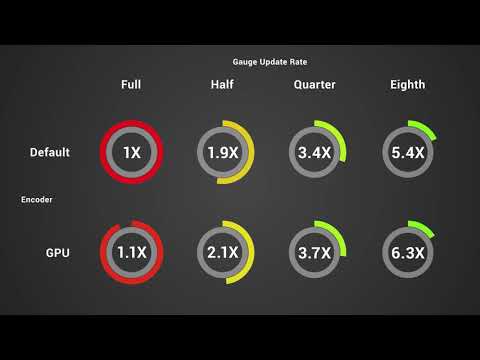
Optimize your exports while maintaining image quality
Import external data from loggers and trackers and sync it to your videos
Display customizable maps and routes in Telemetry Overlay
Top new features of Telemetry Overlay (and Telemetry Extractor)
Improve the GPS signal of your GoPro camera
Learn more advanced Telemetry Overlay features
User Reviews
Professionals and hobbyists alike are joining the Telemetry club