Heads-Up Display for drone videos
Add GPS and sensor metrics to your drone footage
Telemetry Overlay
Finally! An easy all-in-one way to create a heads-up display for your action videos and drone footage. Compatible with multiple camera brands and data formats, including GoPro, DJI (drones and Action 4/5/6/360), Insta360, Garmin, GPX and many more. Merge consecutive videos with GPS data, sync telemetry from multiple sources, customize your gauges and much more.


$299$199
Currency conversion may applyPay once
Use forever
1 Year Updates & Support
Download Telemetry Overlay

Purchase for Windows
Win 10, 11, 12...

Purchase for macOS
Apple Silicon & Intel

Purchase for Linux
DEB & RPM packages
How to add GPS and sensor data to drone videos?
Most drones record their own telemetry data for safety reasons, but GPS and sensor metrics can also enhance both professional and hobbyist activities.
Supported data formats
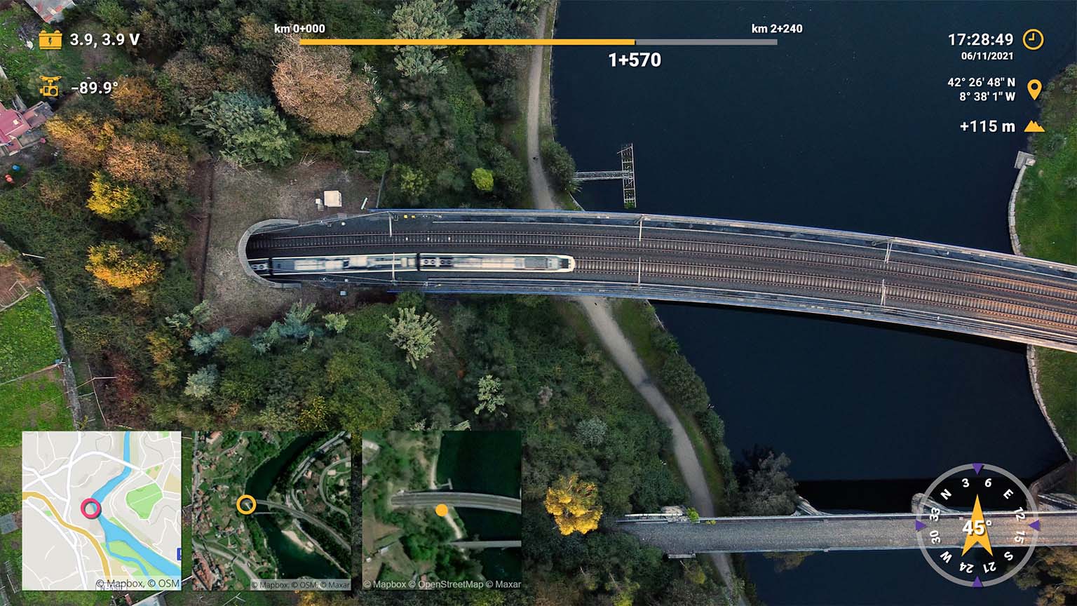
- DJI: Via video subtitles, AirData, Litchi, and Flight Reader CSV logs. Works for Mavic, FPV, Mini, Air, Avata, Neo, Phantom, Matrice...
- Parrot: Via video metadata (Disco, Anafi) and AirData
- Autel: Via AirData CSV logs. models Evo, Nano, Lite...
- Skydio: Via AirData CSV logs
- AirData: Yuneec, Freefly, Wingcopter, Airpeak and more
- FPV: Drones equipped with GoPro (HERO5 and newer)
- Other: Controllers with OpenTX, devices that run ArduPilot, Potensic (via a third-party extractor), and any drone that can record or export GPX files or other supported formats
- More: Test your video data with the free Telemetry Overlay Trial.
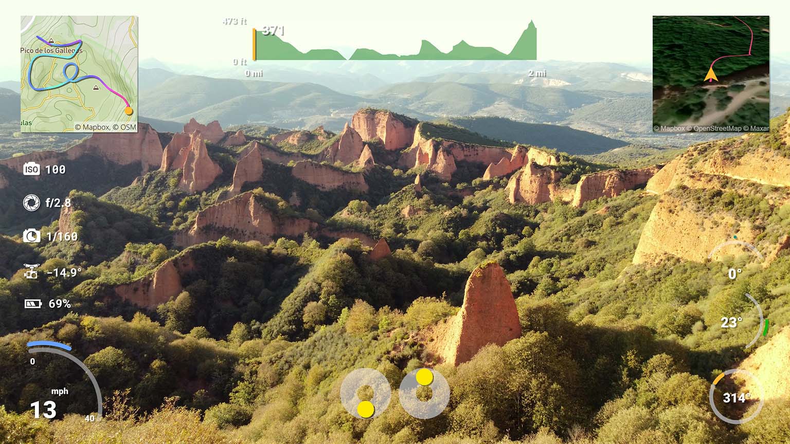
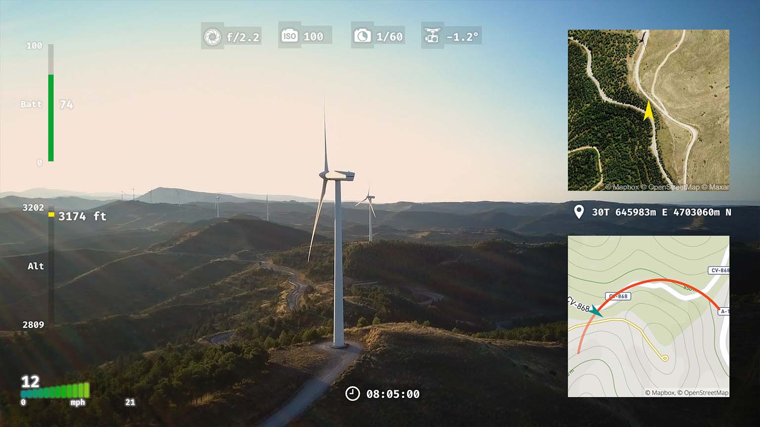
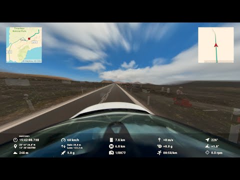
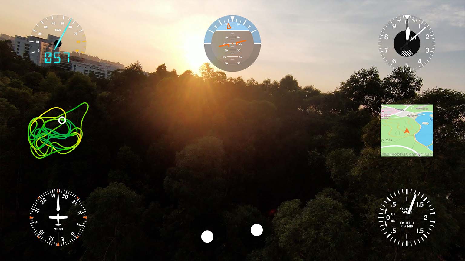
Gauges and presets for drones included
- Customizable GPS path with map/satellite
- Performance gauges like altitude, orientation, speed, distance, attitude (pitch & roll)
- Health metrics like battery, voltage or temperature
- Control data such as thumb stick movement and gimbal position
- Hundreds of other gauges and custom streams from CSV file columns
Availability depends on the data each device records
How to retrieve AirData CSV files
AirData CSV logs enable many more metrics than the videos include by default.
- Register in AirData.com. A free account suffices.
- Upload your flight logs to AirData. See instructions
- Go To AirData.com > My Flights > My Logs, select your flight by date and download it as CSV
If the video contains GPS data, the CSV log will sync automatically. Otherwise you might need to adjust sync manually.
Easy to use
- Drag-and-drop intuitive interface
- Customize shapes, colors and sizes
- Sync external data to camera time automatically in optimal conditions
- Lots of video tutorials and a helpful community
Have more questions? Check out the instructions manual, the tutorials, ask the community, experiment with the Trial version, or get in touch.
Examples
See what other users have created
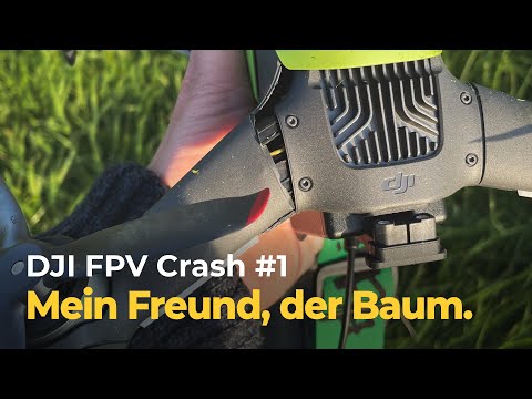
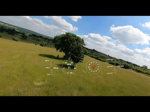
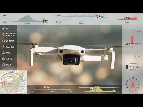
Telemetry data can help with flight and crash analysis
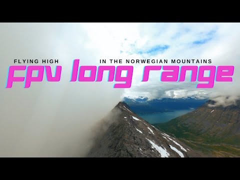
GoPro and DJI OSD drone data combined to enhance a gorgeous long range FPV flight
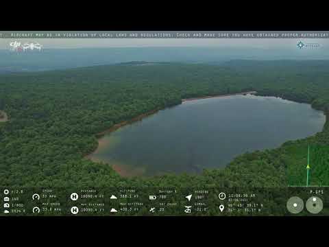
AirData imports contain more data than you may think
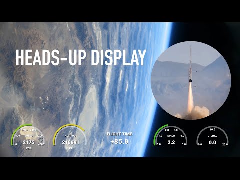
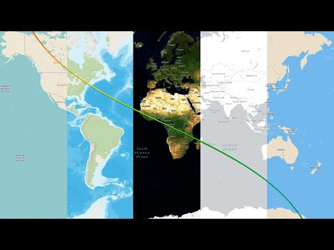
Kip Daugirdas sent an amateur rocket to space!
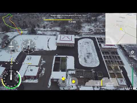
Aviation gauges work great with drone footage too
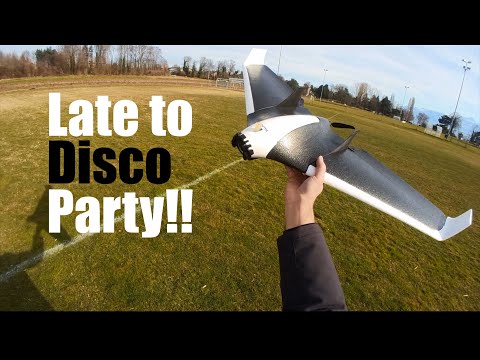
RC planes and FPV wings like the Parrot Disco are great use cases of video and log data
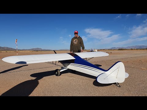
James Ray follows an RC plane with his DJI drone in Manual mode
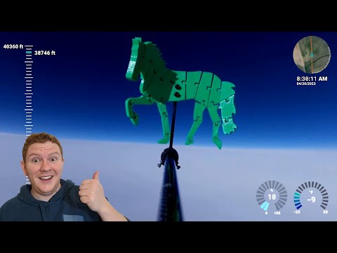
High-Altitude Ballooning Costal Avoidance Device for Early Termination
Drones + 360 cameras + Telemetry Overlay = Iron Man
User Reviews
Professionals and hobbyists alike are joining the Telemetry club
Tutorials
Learn to use the software
Telemetry Overlay supports many more devices and activities!
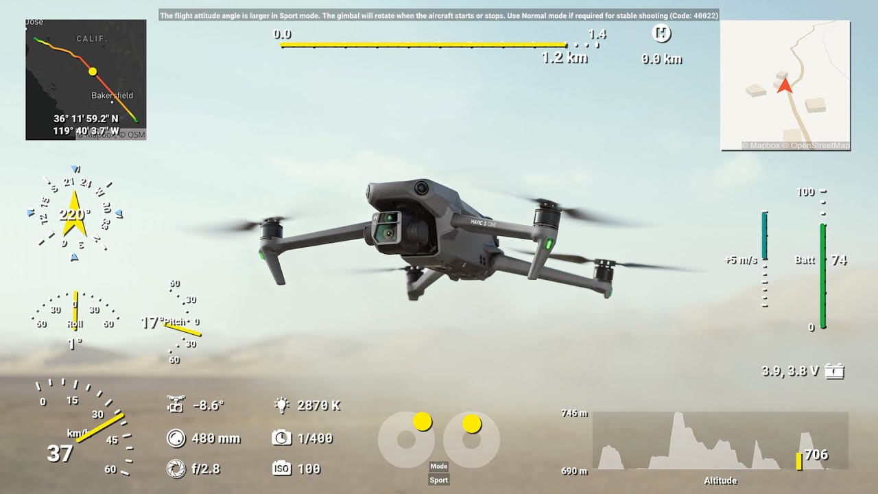
DJI drones have an easy workflow with video subtitle data
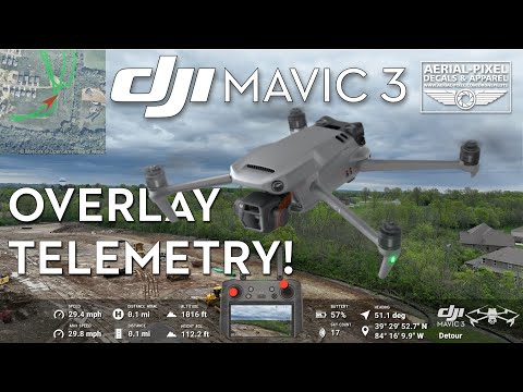
Aerial-Pixels explains their workflow for Mavic 3 video overlays
Sync data from high accuracy flight logs to your videos
Learn to use satellite imagery and map styles in your videos
Export options and best practices
Add GPS and sensor metrics to your drone footage
Not ready? Test the Trial version