Telemetry tools for AirData & Flight Reader
Import advanced data from dozens of drone brands and display hundreds of metrics
Download now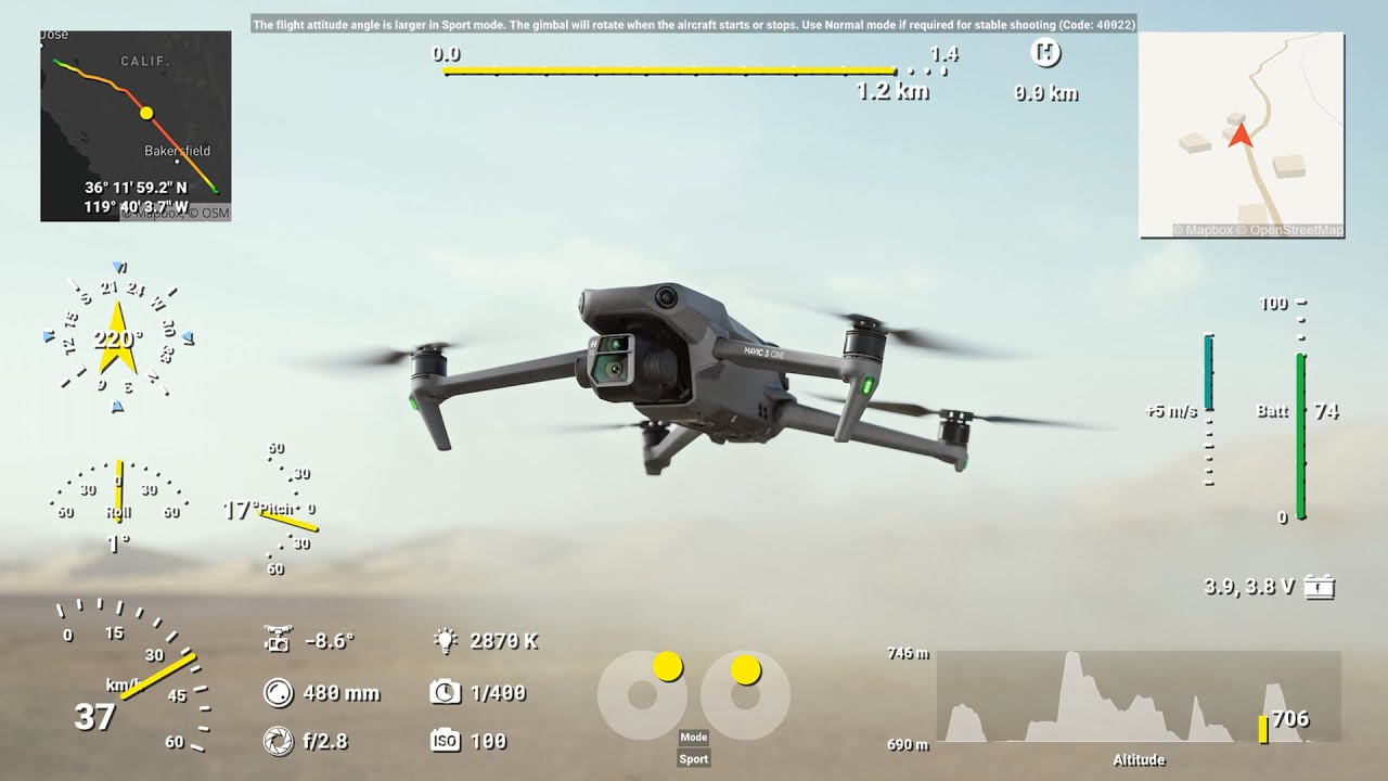
Other drones support within the Telemetry Overlay software
AirData.com allows to store flight logs from multiple brands (DJI, Skydio, Autel, Parrot, Freefly, Wingcopter, Yuneec, Sony Airpeak, SenseFly, Wingtra, Teledyne FLIR, Voliro, Watts Innovations, Flyability, Flybotix...) and download them as CSV files. These contain more data fields than the DJI video captions and are more accurate, but are not always automatically synced. By using both you can sync one to the other and have the best of both worlds.
On the other hand, Flight Reader is a desktop software that decrypts and views the flight data inside of the DJI TXT flight logs, DroneDeploy LOG flight logs, Drone Harmony CSV flight logs, Litchi CSV flight logs, or Map Pilot CSV flight logs from DJI drones. With the "Read extra streams" setting in Telemetry Overlay many more data streams will become available for Custom gauges.
Supported gauges in Telemetry Overlay
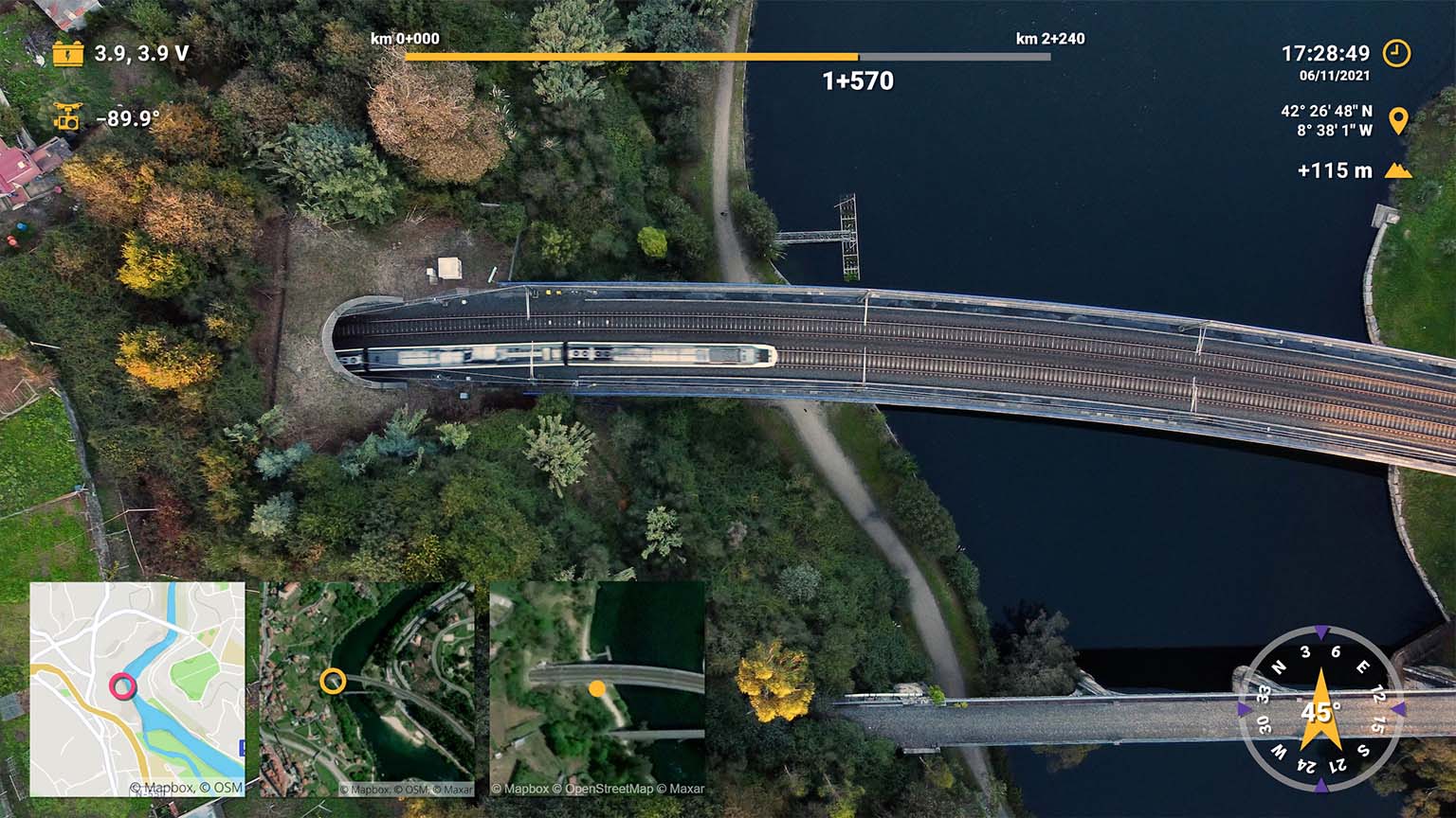
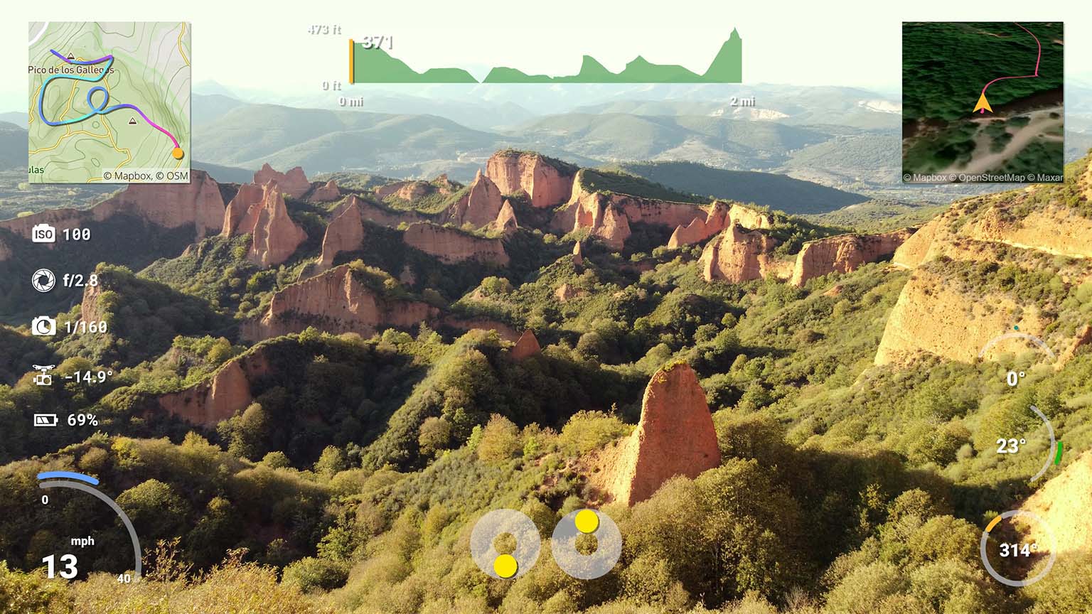
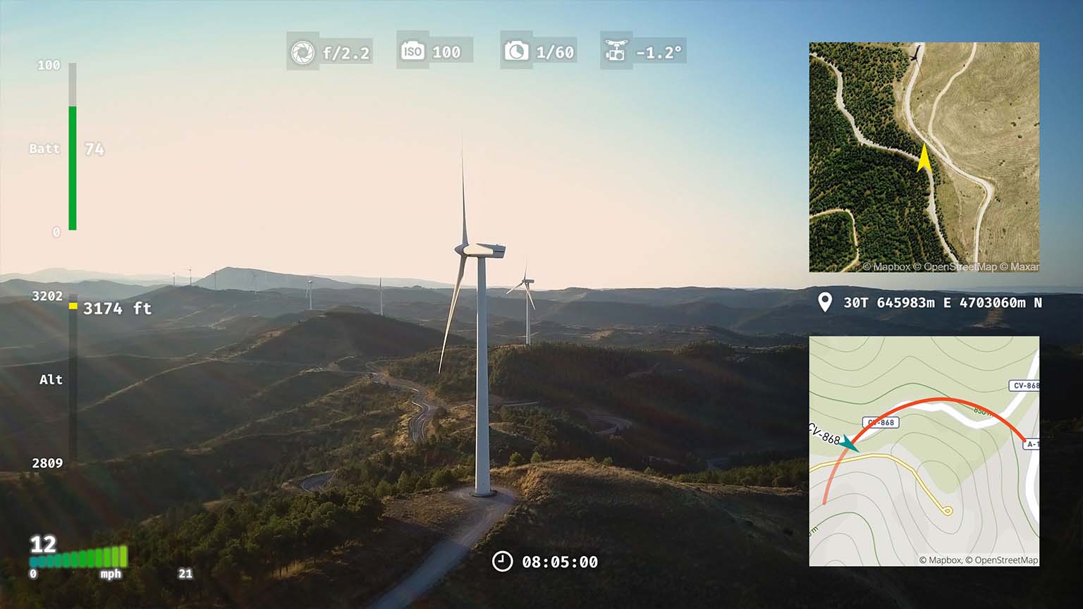
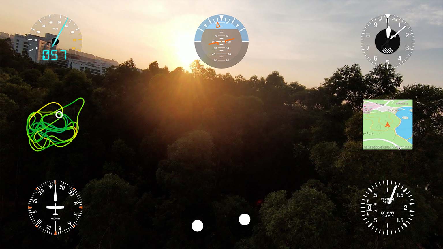
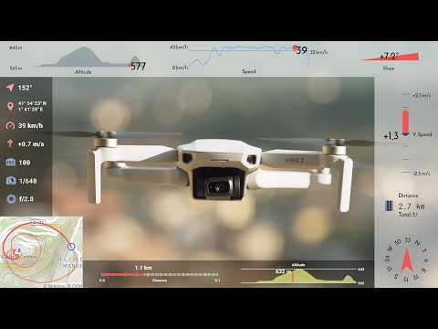
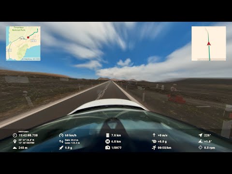
Speedometer, GPS Path, Altitude, Distance, Slope, Dynamic Map, Bearing, Acceleration (GPS), Time & Date, Lap Timer, Pace, Vertical Speed, Elevation Gain, Coordinates, Altitude vs Distance, Orientation, Heading, Gimbal, Gimbal Heading, Thumbsticks, Battery %, Lean Angle, Lean Angle (2 wheel), Airspeed, Altimeter, Attitude Indicator, Heading Indicator, Turn Coordinator, Vertical Speed Indicator, Pitch Angle, Longitudinal Acceleration (GPS), Acceleration (speed-based), Lateral Acceleration (GPS), Zero to Speed, Distance Timer, GPS Path + Compass, Battery Volts, Distance Home, Sector Times, Corner Speeds, Custom, Dynamic Text, Static Title, Static Image, Export GPX, Embed Timecode, Watermark and Additional streams.
Availability may vary between devices and recording conditions.
- Register in AirData.com
- Upload your flight logs to AirData. See instructions
- Go To AirData.com > My Flights > My Logs, select your flight by date and download it as CSV
Not all drone models include all the data streams. Even more drone models can be supported with other import methods and formats, like DJI subtitles logs, Parrot, OpenTX, GPX, GoPro... See their corresponding section.
Telemetry Overlay supports most video formats and dozens of embedded and external data formats.
Gauges can be customized to a great extent, but presets and defaults can make the user experience extremely easy.
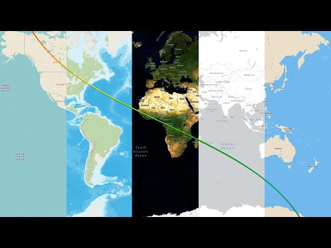
Map and satellite imagery is available for representing GPS data.
Export formats for both professional and social use are available.
Lots of documentation, tutorials and an active community help achieve great results.
Have more questions? Check out the instructions manual, the tutorials, ask the community, experiment with the Trial version, or get in touch.
Telemetry Overlay
Finally! An easy all-in-one way to create a heads-up display for your action videos and drone footage. Compatible with multiple camera brands and data formats, including GoPro, DJI (drones and Action 4/5/6/360), Insta360, Garmin, GPX and many more. Merge consecutive videos with GPS data, sync telemetry from multiple sources, customize your gauges and much more. | Learn more
$299$199
Currency conversion may applyPay once
Use forever
1 Year Updates & Support
Download Telemetry Overlay

Purchase for Windows
Win 10, 11, 12...

Purchase for macOS
Apple Silicon & Intel

Purchase for Linux
DEB & RPM packages
Tutorials
Learn to use the software
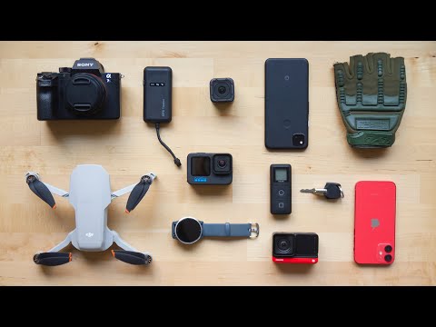
Telemetry Overlay supports many more devices and activities!
DJI drones have an easy workflow with video subtitle data
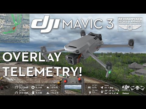
Aerial-Pixels explains their workflow for Mavic 3 video overlays
Sync data from high accuracy flight logs to your videos
Learn to use satellite imagery and map styles in your videos
Export options and best practices
User Reviews
Professionals and hobbyists alike are joining the Telemetry club