Telemetry Overlay for aviation
Add flight log data and instruments to aviation videos
Telemetry Overlay
Finally! An easy all-in-one way to create a heads-up display for your action videos and drone footage. Compatible with multiple camera brands and data formats, including GoPro, DJI (drones and Action 4/5/6/360), Insta360, Garmin, GPX and many more. Merge consecutive videos with GPS data, sync telemetry from multiple sources, customize your gauges and much more.


$299$199
Currency conversion may applyPay once
Use forever
1 Year Updates & Support
Download Telemetry Overlay
Purchase for Windows
Win 10, 11, 12...

Purchase for macOS
Apple Silicon & Intel

Purchase for Linux
DEB & RPM packages
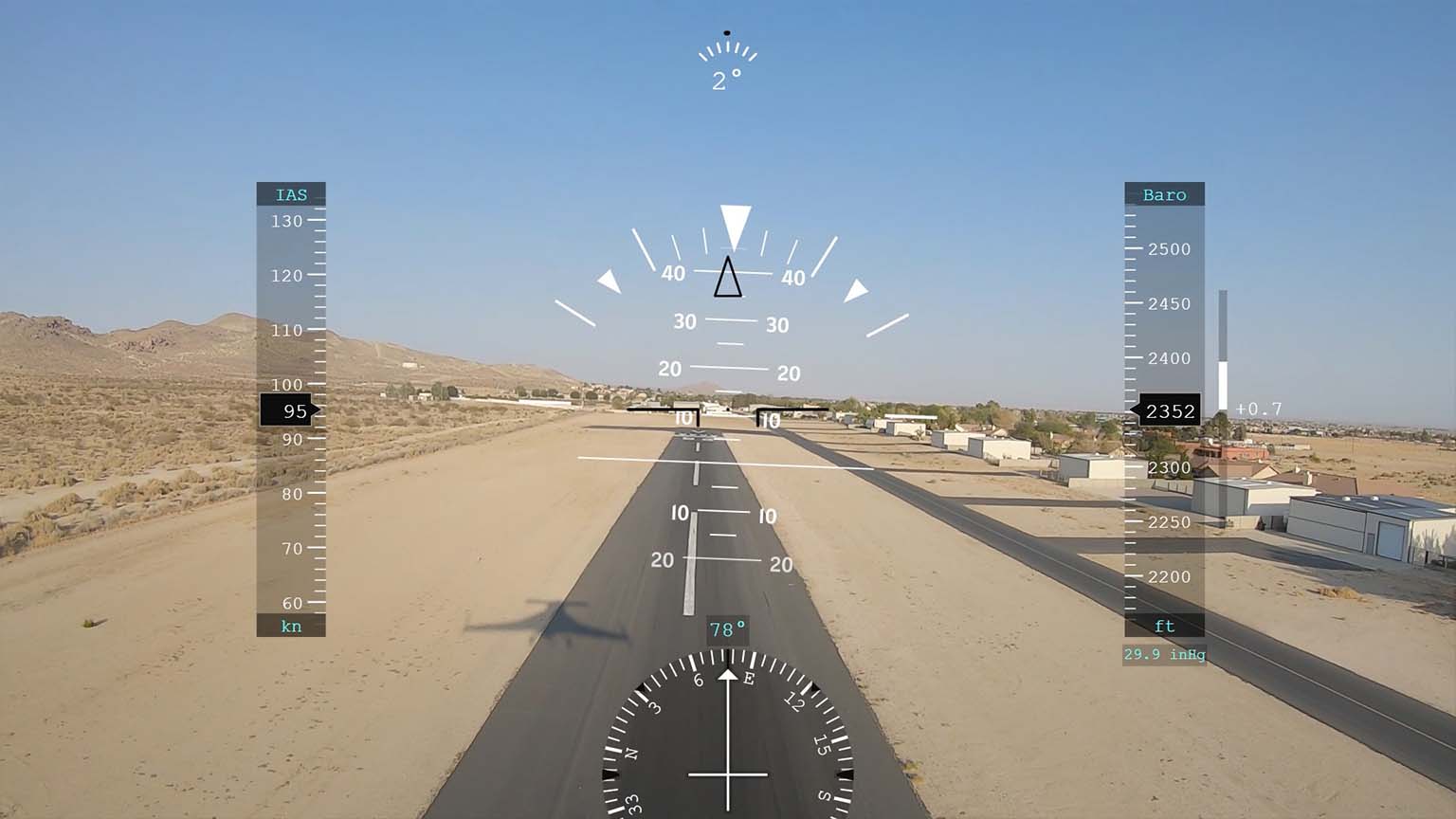
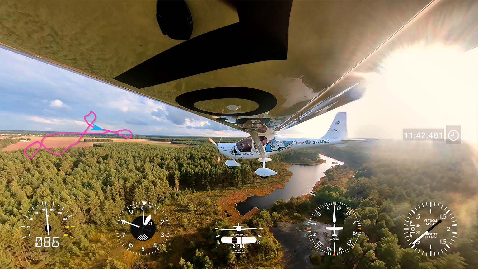
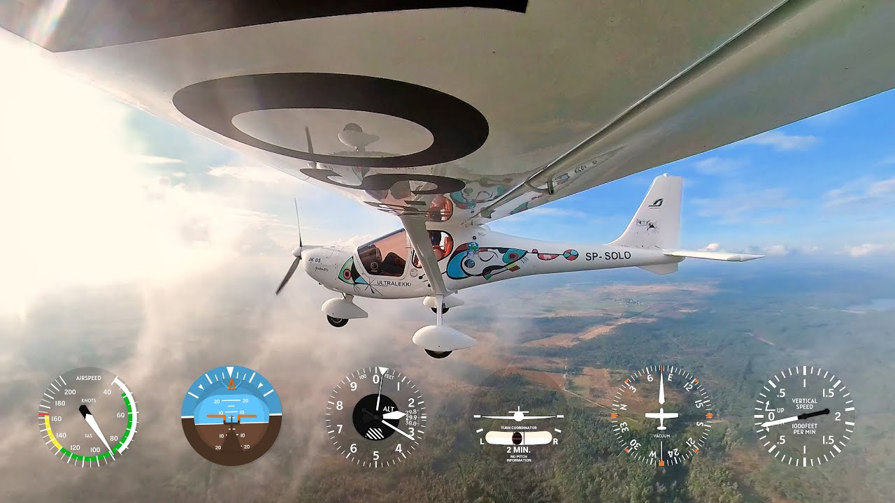
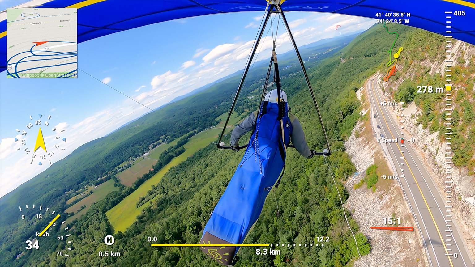
Video dashboard from camera data and flight logs
GPS-enabled cameras are enough to create videos with data overlays, but instrument-based flight logs can take them to another level
Supported data formats
Dozens of formats and loggers are supported
- Garmin Flight Instruments (CSV format): G1000, G2000, G300, G5, G3X Touch, G600, G500 TXi, GTN 750, G3000, GI275...
- Altimeters and instruments: FlySight, GRT Avionics EFIS, Dynon Avionics...
- Cameras with embedded data: GoPro, Insta360, DJI drones...
- Data from Android or iPhone apps (GPX)
- Standard formats: IGC, GPX, KML, TCX, CSV and more (see manual)
Easy to use
- Drag-and-drop intuitive interface
- Customize shapes, colors and sizes
- Sync external data to camera time automatically in optimal conditions
- Lots of video tutorials and a helpful community
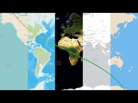
Map imagery
Add static and moving maps showing your position with different map styles or satellite imagery. Use the default MapBox styles or create your own through MapBox Studio.
Hundreds of gauges
Airspeed indicator, ground speed, altimeter, GPS Path, Heading indicator, vertical speed (variometer/rate of climb), turn coordinator, attitude, battery, engine RPM, oil, temperature and many more custom streams.
Availability depends on imported data.
Import more metrics from your logger and create custom gauges of any style
Aviation presets
Create an aviation heads-up-display in moments by using one of the presets: Aviation or Skydiving
And copy more gauges and styles from other presets: drone, motorsports, cycling, sailing...
Have more questions? Check out the instructions manual, the tutorials, ask the community, experiment with the Trial version, or get in touch.
Examples
See what other users have created
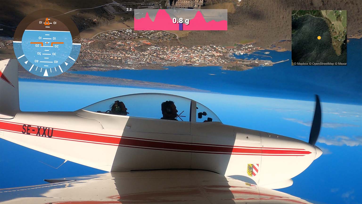
Importing instrument data (Dynon, Garmin) enables endless custom streams and visualizations
Classic-looking instruments combined with minimal data fiels and GPS maps
MEM from the Hungarian Air Force performs a spectacular airshow at Zeltweg

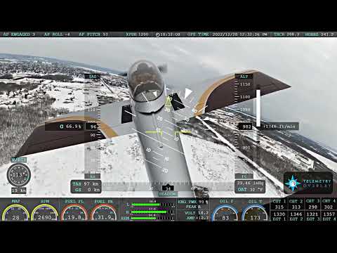
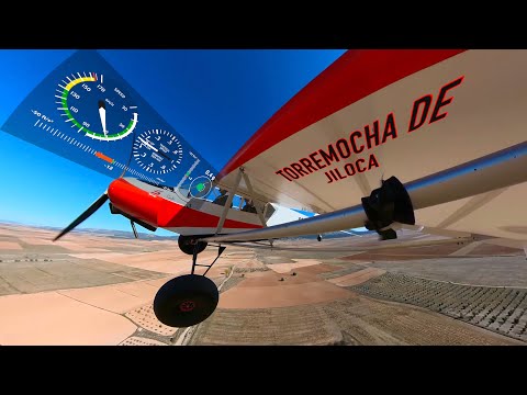
Scott flies beautifully with Tape gauges from the Plane HUD preset and Custom ones
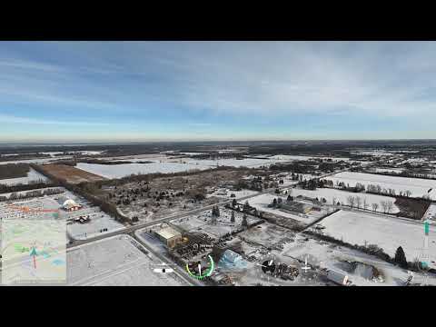
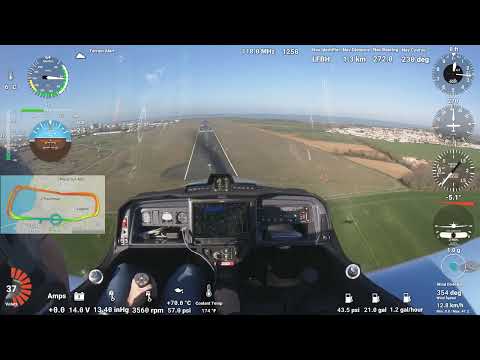
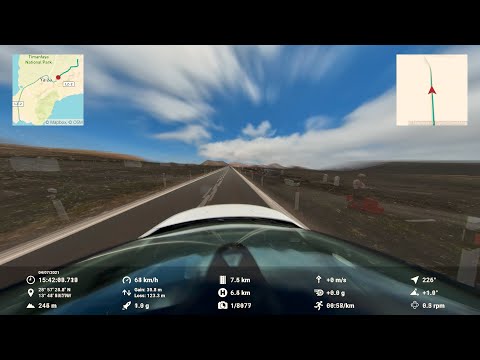
Departure from CYRP in C-GIME with GoPro Telemetry data
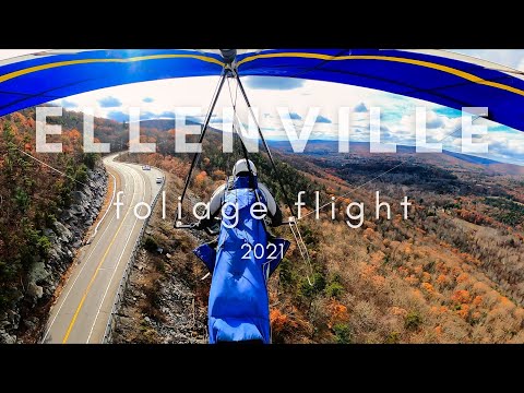
Michael Strother shows off the glide ratio of his hang glider with IGC data
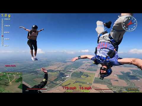
NitrowolfUT enhances his sky dives with Telemetry Overlay
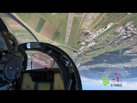
Immersive aviation videos with a floating instrument panel are now possible
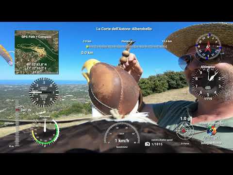
AirFilm.it mounted a striped down gopro and a GPS sensor on an eagle. Really impressive!
User Reviews
Professionals and hobbyists alike are joining the Telemetry club
Tutorials
Learn to use the software
How to use Telemetry Overlay
Import external data from loggers and trackers and sync it to your videos
Improve the GPS signal of your GoPro camera
Learn to use satellite imagery and map styles in your videos

Workflow for 360 VR videos
Export options and best practices
Add flight log data and instruments to aviation videos
Not ready? Test the Trial version