How to use DJI flight logs in After Effects?
Most DJI drones record flight logs as subtitle data. Learn to import it in After Effects to create custom overlays
Which drones are supported?
- Mavic (Pro, Air 2, 2 Pro/Zoom, 3, 4, Mini)
- Air (2, 2s, 3, 3s)
- Mini 2/3/4/5/Pro
- Neo (2 & 1)
- FPV/Avata/2/360
- Phantom (3, 4, Pro)
- Inspire
- Matrice
Some drones record the data in a separate .SRT file (caption, subtitles), while others embed it in the MP4 video file.
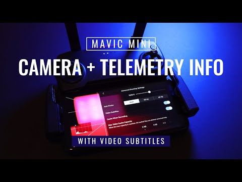
How to record the data?
Before your flights, make sure to enable the Video Captions option in the Camera Settings of the DJI Go 4 App
Can I join consecutive files?
Yes. You can load multiple .SRT files on the Flight Data Viewer at the same time. They will be sorted and merged based on their date. This will allow you to visualize more complex flights.
What else can the DJI SRT Viewer do?
It can visualize the data over map and satellite imagery and export the data to a range of formats
- GPX (GPS Exchange Format)
- KML (Keyhole Markup Language)
- CSV (Comma Separated Values)
- JSON (JavaScript Object Notation)
- mgJSON (After Effects animation)
- PNG (Screenshot)
- WebM (GPS map video)
Can the project be longer than 1 hour?
Yes. Expand the duration of your composition from its settings, unhide and unlock all the hidden layers and extend their duration as well.
Keep in mind that Adobe After Effects cannot import mgJSON files longer than 3 hours. If that is what you need, either find a way to compress the duration of your data before converting it to mgJSON, or use Telemetry Overlay instead.
Is there an easier alternative?
Yes. Telemetry Overlay allows you to create your data dashboard without the need of third-party professional tools like After Effects. It has an easy drag-and-drop interface, hundreds of customization options and more gauge options and data types.
Can I share my video with telemetry somewhere?
Yes, please! The Facebook community is probably the best place to do so, but if you prefer to do it somewhere else, get in touch to increase your audience.
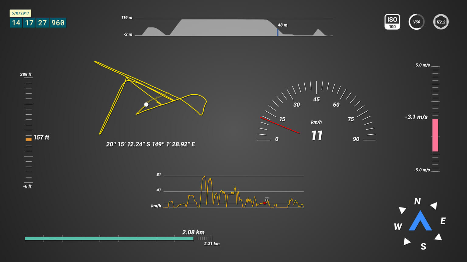
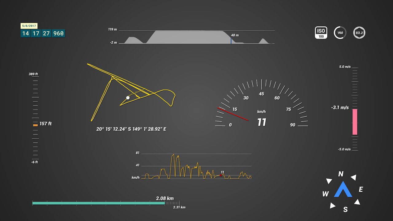
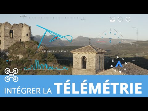
What gauges are available?
Speed, Distance, Altitude, GPS Path, Altitude Path (graph vs time), Speed Tracker (graph vs time), Course Direction, Camera Settings (ISO, Shutter Speed and Aperture), Vertical Speed and Time. Some drone models do not include all the gauges
How to import the data in Adobe After Effects?
You will need to retrieve the .SRT files, located next to the video file in the SD card. If your drone does not generate the files (Mavic Mini, Phantom 4 Pro, Inspire 2), you can generate them from the MP4 file with the Subtitle Extractor.
Load your .SRT on the Flight Data Viewer to visualize your GPS on a map or satellite images. Then export it to mgJSON (After Effects animation)
Use the DJI Telemetry Overlay for After Effects to select the gauges you want to display. Import the MGJSON file, drop it into the desired gauge composition and use the Control layer's effects panel to set the imported data as a source and customize how it looks.
The data looks shaky. Can this be fixed?
To some extent. The subtitle data of some models is not a 100% accurate and needs smoothing in order to look accurate. You can play with the smoothing control both in the DJI SRT Viewer and in the After Effects Template until you find the sweet spot for your use case and model.
What software do I need in order to run this?
Adobe After Effects 2020 or newer.
Can the GPS Path show satellite images or Google Maps?
Not easily. For that, use Telemetry Overlay instead.
Is this a subscription or a one-time payment?
Pay once. Use forever!
Plus, get support for one year, then optionally extend it for a fraction of the initial cost.
Have more questions? Check out the instructions manual, ask the community, experiment with the Trial version, or get in touch.
$69
Currency conversion may applyPay once
Use forever
1 Year Support
Download Telemetry Template for DJI (Adobe AE)

Purchase Full Template
Available now
Examples
See what other users have created
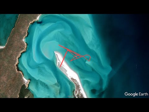
You can create 3D visualizations of your flights on a Google Earth map
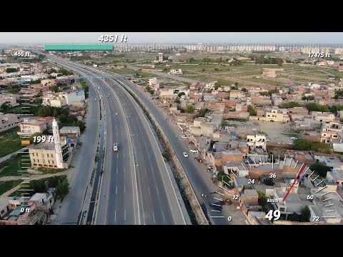
Do on site aerial surveyance while tracking your flight stats
Fantastic review of these tools! (en français)
Extract the DJI subtitle data from the video file (P4P, Mavic Mini, Inspire 2...)
Inspecting the area with the help of subtitle flight log data

When we were promised drone deliveries we were not thinking of this
Which product do I need?
Telemetry Overlay
Telemetry Extractor
User Reviews
Professionals and hobbyists alike are joining the Telemetry club