Finally an easy way to view (SRT) flight data
Originally published in the DJI Forum.
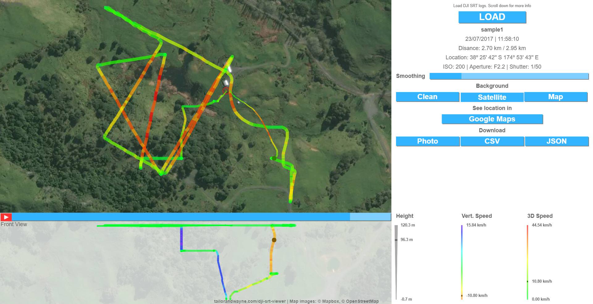
SRT logs have been there in our SD cards for a while. They appear when you turn on "Video Captions" in the Go4 App, but they are not very accurate (not enough location digits are included, only recorded once every second...), so not many people have been using them for anything.
I decided to give them a try, and have been playing with ways of visualizing them. It turns out they can provide some interesting information if you combine data entries to smoothen the paths, speeds and so on. Accuracy is still an issue DJI should address, but I find it fun to visualize the paths of my flights and get an approximation of speeds, distance and so on.
Feel free to test the tool I created. Please share anything fun you visualize with it, report bugs, suggest new features and send me your drone's logs if they are not supported yet. I will clean up and publish the source code for anyone to contribute when I get some spare time.
Here it is: https://djitelemetryoverlay.com
Update: In successive iterations, new features were added:
- Support for other drones, trackers and data formats
- Merge more than one SRT file (useful if the recording was interrupted)
- Accessory tools like a subtitle exporter
- Export data to formats like gpx, kml or After Effects
- Create videos with the subtitle data with the Template for After Effects